
Title
Autonomous Features Extraction Tool
Overview
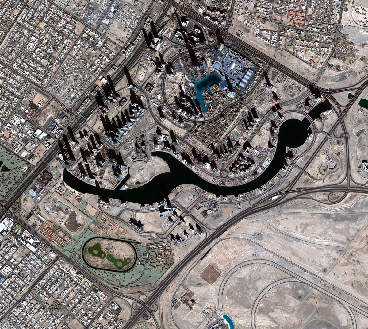
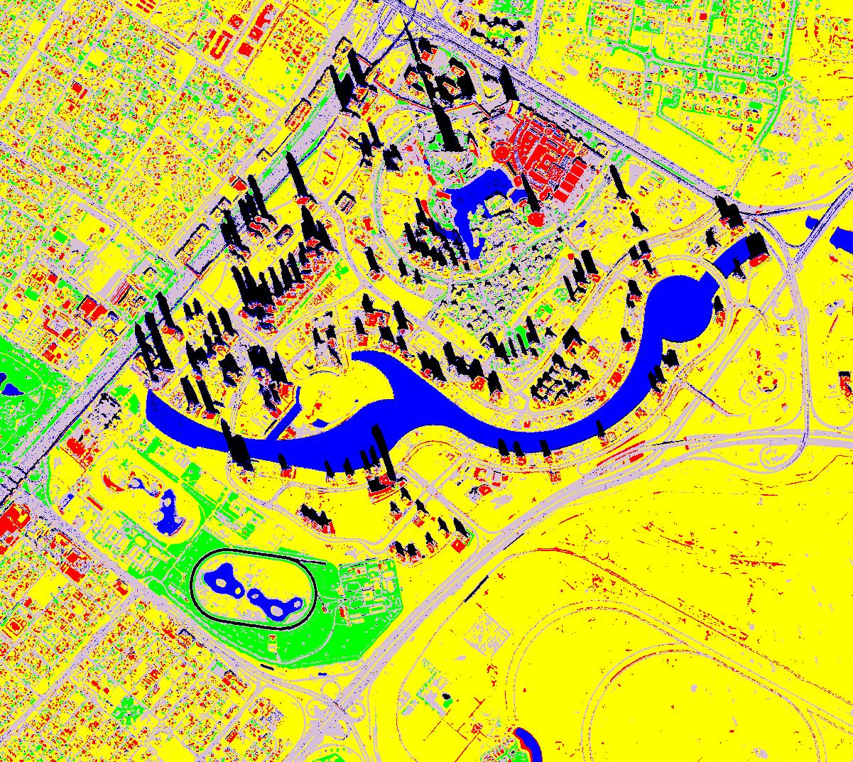
The aim of this project is to develop an autonomous features extraction tool that allows the user to classify and extract the main features presented in KhalifaSat images such as water bodies, vegetation areas, road networks and paved areas, buildings and undeveloped areas from their end with minimal human interaction from the end-user (i.e. pre and post-processing). Mapping of these features brings a huge benefit as it facilitates many governmental routine tasks.
The tool shall be easily integrated with the existing infrastructure in the government entities. The generated output shall be compatible with ArcGIS data format that is considered as a standard format across different government entities. The tool shall be able to exchange data from/to government database.
KhalifaSat is the third Emirati remote sensing earth observation satellite owned and operated by Mohammed Bin Rashid Space Center (MBRSC), Dubai. It is planned to be launched by 2018. KhalifaSat will provide electro-optical data with a spatial resolution of 0.75m for panchromatic imagery and 2.98m for multispectral imagery that includes 4 bands; red, green, blue and near infra-red with a quantization rate of 10 bits.
Results
Related Projects

A Low Cost, Efficient Electrical Power System Design for CubeSat
Flight Software Design and Implementation for a CubeSat
Air Quality Management Zonation using Spatial-Temporal Statistical Analysis, Dubai-UAE